Garmin Tread - Overland Edition 8"
What's in the Box
- Tread - Overland Edition
- Suction cup mount
- Vehicle power cable
- Locking magnet-assisted mount
- USB-C cable
- Documentation
ROAM THE UNKNOWN
Built for every part of the journey, this rugged all-terrain navigator has the mapping you need to stay on track and communication technology to stay in touch while you’re out there.
Navigate unpaved roads and trails by using turn-by-turn trail navigation1 with OpenStreetMap (OSM) and USFS Motor Vehicle Use Maps.
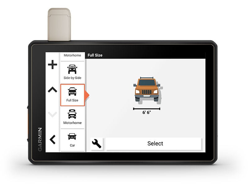
Custom routing for the size and weight of your rig2 and preloaded iOverlander™ points of interest (POIs) help you find where to set up camp.
See vivid aerial views of terrain with downloadable, subscription-free BirdsEye Satellite Imagery.
Use the Tread® app on your compatible smartphone to sync data across your various devices and plan routes.
Peace of mind comes built-in. With an active subscription, you can use inReach® technology for global satellite communication.
OFF-ROAD RUGGEDNESS
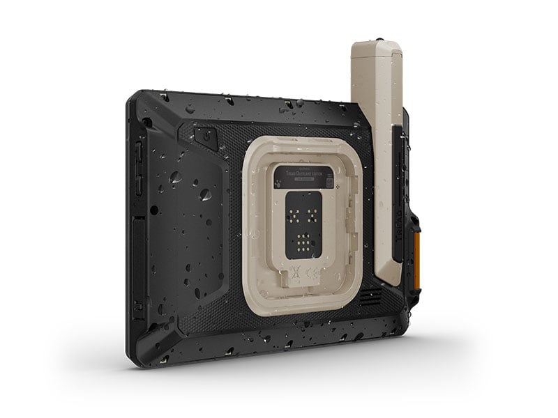
Purpose-built for all-terrain use, this Tread device stands up to anything the elements can throw at it. It’s IP67-rated for water-resistance.

HIGH-VISIBILITY DISPLAY
With its ultrabright 8” glove-friendly touchscreen, the navigator is designed for easy viewing in bright sunlight or pitch dark. It can be mounted in portrait or landscape mode.
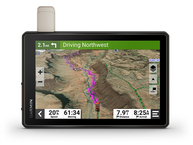
TRAIL NAVIGATION
Enjoy turn-by-turn trail navigation for traversing unpaved roads and trails using adventure roads and trails map content comprised of OSM and USFS Motor Vehicle Use Maps.
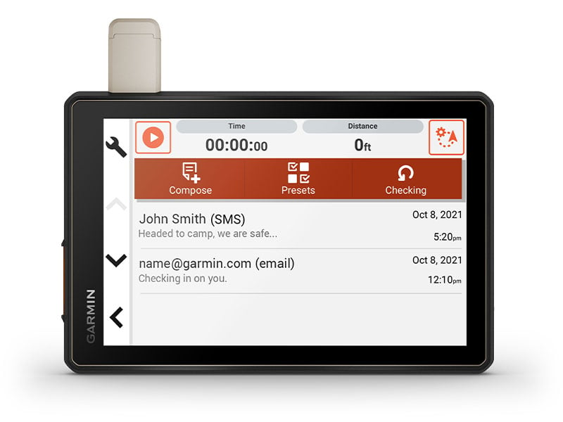
BUILT-IN INREACH TECHNOLOGY
Built-in inReach technology offers global satellite communication3, two-way text messaging, location sharing and interactive SOS.
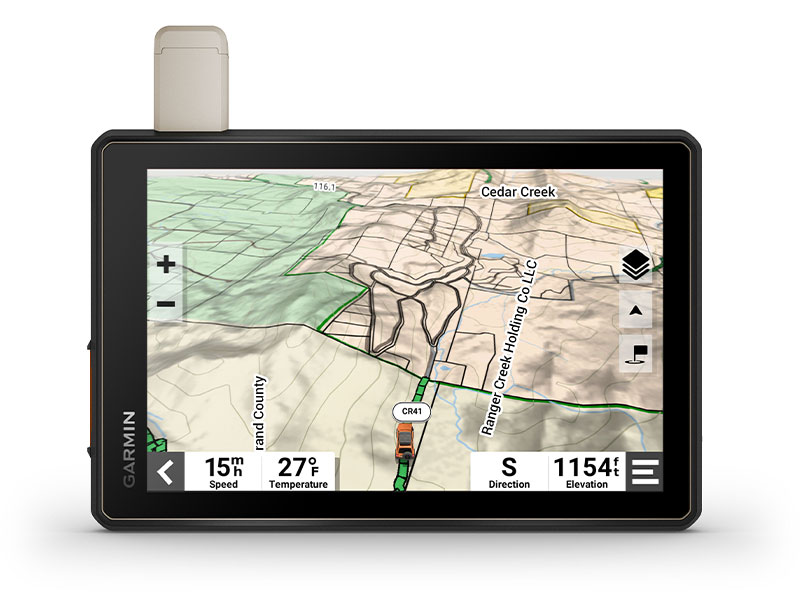
MAPS ON AND OFF-ROAD
Tread includes preloaded topographic maps with 3D terrain for North and South America. It also includes detailed street maps of North America with custom routing for the size and weight of your rig2.
KNOW YOUR BOUNDARIES
Access U.S. public land boundaries for national forests, Bureau of Land Management (BLM), wilderness areas and more. Also, see U.S. private land boundaries and landowner information for parcels greater than 4 acres.
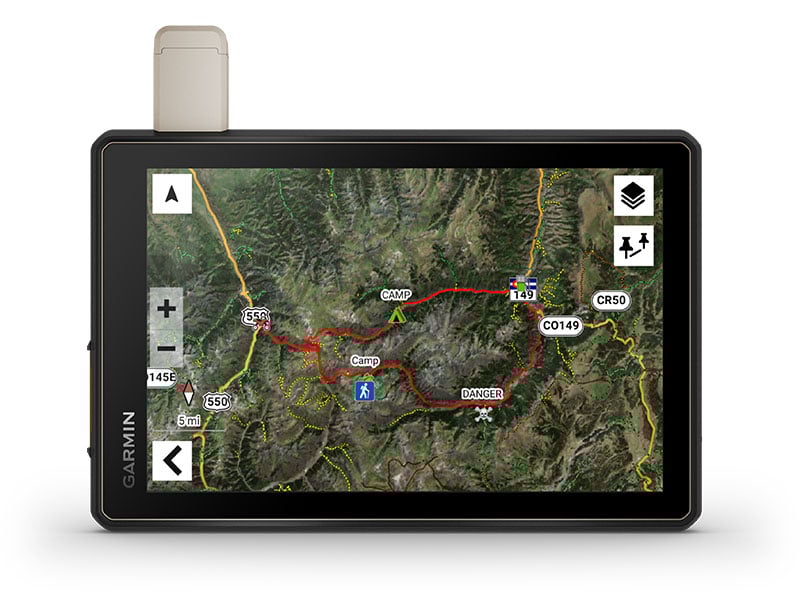
SATELLITE IMAGERY
Enjoy vivid aerial views when you download high-resolution BirdsEye Satellite Imagery directly to your device via Wi-Fi® connectivity, with no annual subscription required.
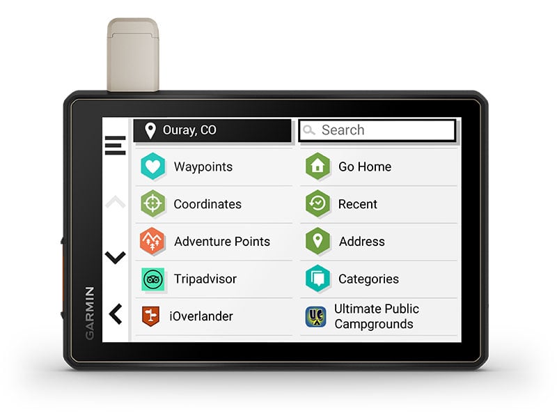
POINTS OF INTEREST
Tread comes preloaded with iOverlander points of interest and Ultimate Public Campgrounds, so you don’t need a cell signal to route to the best-established, wild and dispersed campsites.
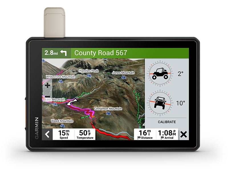
ABC SENSORS
When you’re headed to tough-terrain, the built-in sensors will come in handy — including an altimeter, barometer, compass and pitch/roll gauges.
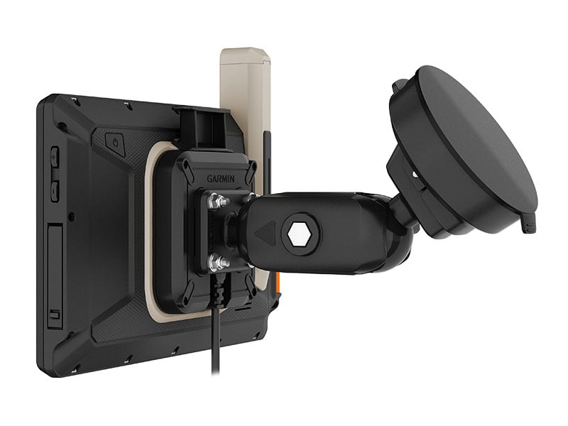
SECURE MOUNT
Use the included locking magnet-assisted mount to secure the navigator to your vehicle.

Connect for a better adventure.
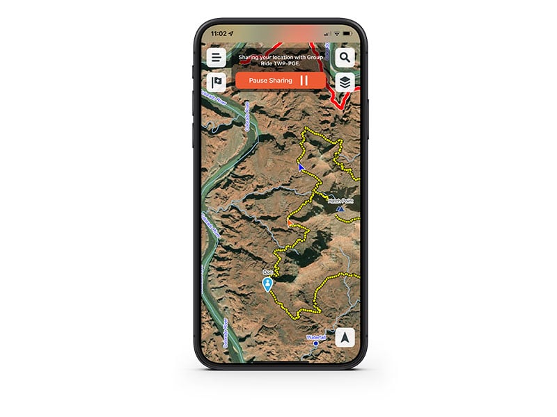
GROUP RIDE MOBILE
Track friends from your compatible smartphone or Tread device when you and your friends use the Tread app’s Group Ride Mobile feature.
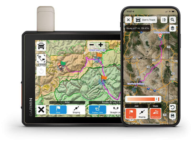
EASY ROUTE PLANNER
Use the Tread app to easily plan routes with the same maps, vehicle profiles and route preferences that you have on the Tread device.
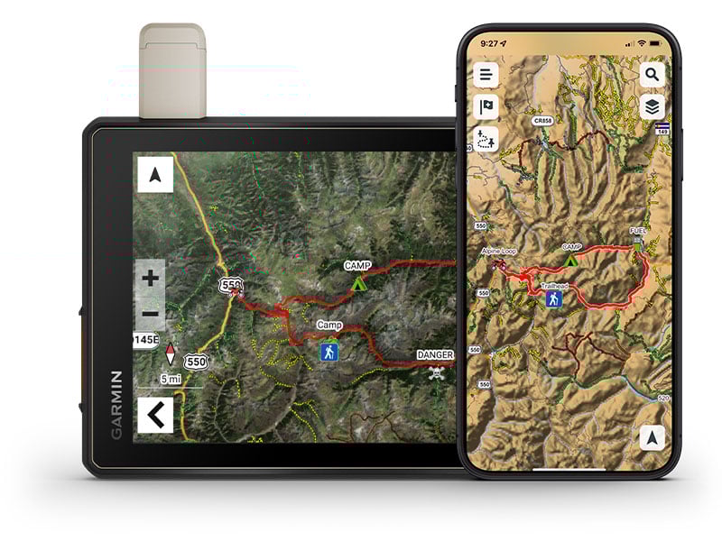
EASILY SYNC YOUR DEVICES
Use the Tread app to sync waypoints, tracks, routes and collections across all your devices. Easily import and share GPX files, too.
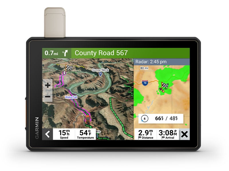
LIVE WEATHER
Weather ahead? Pair your Tread device with your compatible smartphone, and download the Tread app to access live weather, storm alerts, animated radar and more.